Land Navigation Module
- Compact
- Waterproof
- Condensed
- Modular
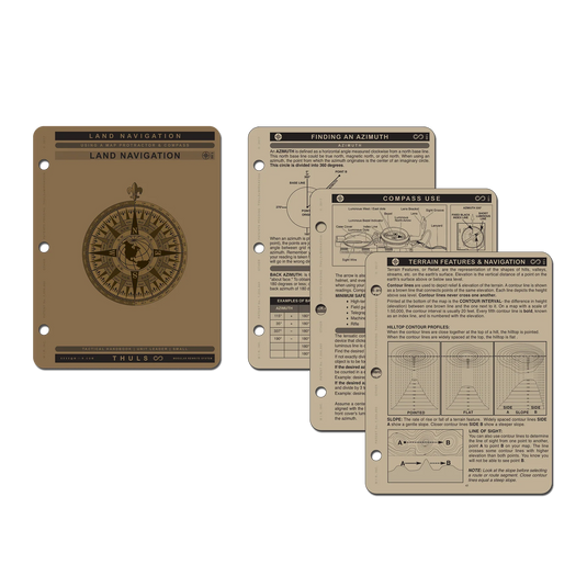
Description: Land nav checklist, Lateral effect per degree of offset, Calculating grade ratios, G-m conversion, Map scale measurements, Pace count log, Pace count travel time chart, Military Grid Reference System, Grid zone designator, How MGRS works, Components of an MGRS map, UTM coordinates, UTM maps, Finding a known location, Determining distance on a map, Protractors, Finding an azimuth, Compass use, Orientating a map, Compass error, North | declination | G-M angle, Finding your current position on a map, Resection, Modified resection, Modified resection- linear, Intersection, Determining relief and elevation, Determining grade,Terrain features & navigation, Manmade cuts, Streams, Terrain association, Major, minor, man-made features, Handrails, Catching features attack points, Steering marks, Offset, Route planning, Lateral drift / steering marks, Aiming off, Pace count, Navigation techniques, Terminology, Basic Landnav techniques, Dead reckoning, Terrain association, Situational techniques, Intentional offsetting, 90 degree offset.
Check out the other modules and combine the ones you need. And don't forget a set of locking rings to hold them all together!